


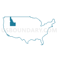
Bingham (Outside Fort Hall AIR), Madison, Jefferson, Fremont & Teton Counties PUMA, Idaho
About
Outline
%2c+Madison%2c+Jefferson%2c+Fremont+%26+Teton+Counties+PUMA%2c+Idaho_A280.png)
Summary
| Unique Area Identifier | 192781 |
| Name | Bingham (Outside Fort Hall AIR), Madison, Jefferson, Fremont & Teton Counties PUMA |
| State | Idaho |
| Area (square miles) | 5,693.35 |
| Land Area (square miles) | 5,618.57 |
| Water Area (square miles) | 74.79 |
| % of Land Area | 98.69 |
| % of Water Area | 1.31 |
| Latitude of the Internal Point | 43.76975500 |
| Longtitude of the Internal Point | -111.93928030 |
Maps
%2c+Madison%2c+Jefferson%2c+Fremont+%26+Teton+Counties+PUMA in Idaho.png)
Graphs
Select a template below for downloading or customizing gragh for Bingham (Outside Fort Hall AIR), Madison, Jefferson, Fremont & Teton Counties PUMA, Idaho
%2c+Madison%2c+Jefferson%2c+Fremont+%26+Teton+Counties+PUMA%2c+Idaho_T0.png)
%2c+Madison%2c+Jefferson%2c+Fremont+%26+Teton+Counties+PUMA%2c+Idaho_T1.png)
%2c+Madison%2c+Jefferson%2c+Fremont+%26+Teton+Counties+PUMA%2c+Idaho_T2.png)
%2c+Madison%2c+Jefferson%2c+Fremont+%26+Teton+Counties+PUMA%2c+Idaho_T3.png)
%2c+Madison%2c+Jefferson%2c+Fremont+%26+Teton+Counties+PUMA%2c+Idaho_T4.png)
%2c+Madison%2c+Jefferson%2c+Fremont+%26+Teton+Counties+PUMA%2c+Idaho_T5.png)
%2c+Madison%2c+Jefferson%2c+Fremont+%26+Teton+Counties+PUMA%2c+Idaho_T6.png)
%2c+Madison%2c+Jefferson%2c+Fremont+%26+Teton+Counties+PUMA%2c+Idaho_T7.png)
%2c+Madison%2c+Jefferson%2c+Fremont+%26+Teton+Counties+PUMA%2c+Idaho.png)
Neighbors
Neighoring Public Use Microdata Area (by Name) Neighboring Public Use Microdata Area on the Map
- Bonneville County--Idaho Falls City PUMA, ID
- Central Idaho--Lewiston City & Nez Perce Reservation PUMA, ID
- Elmore, Jerome, Blaine, Minidoka, Gooding, Lincoln & Camas Counties PUMA, ID
- Sheridan, Park, Teton, Lincoln & Big Horn Counties PUMA, WY
- South Central Montana--Bozeman City PUMA, MT
- Southeast Idaho--Pocatello, Chubbuck Cities & Fort Hall Reservation PUMA, ID
- Southwest Montana--Butte-Silver Bow & Helena City PUMA, MT
Top 10 Neighboring County (by Population) Neighboring County on the Map
- Bonneville County, ID (104,234)
- Gallatin County, MT (89,513)
- Bannock County, ID (82,839)
- Bingham County, ID (45,607)
- Madison County, ID (37,536)
- Jefferson County, ID (26,140)
- Blaine County, ID (21,376)
- Teton County, WY (21,294)
- Fremont County, ID (13,242)
- Teton County, ID (10,170)
Top 10 Neighboring County Subdivision (by Population) Neighboring County Subdivision on the Map
- Idaho Falls CCD, Bonneville County, ID (95,095)
- Rexburg CCD, Madison County, ID (30,871)
- Rigby CCD, Jefferson County, ID (16,274)
- Blackfoot CCD, Bingham County, ID (14,694)
- Moreland CCD, Bingham County, ID (10,134)
- Shelley CCD, Bingham County, ID (8,203)
- St. Anthony CCD, Fremont County, ID (8,141)
- Sugar City CCD, Madison County, ID (6,416)
- American Falls CCD, Power County, ID (6,166)
- Ucon CCD, Bonneville County, ID (6,125)
Top 10 Neighboring Place (by Population) Neighboring Place on the Map
- Rexburg city, ID (25,484)
- Blackfoot city, ID (11,899)
- Shelley city, ID (4,409)
- Rigby city, ID (3,945)
- St. Anthony city, ID (3,542)
- Aberdeen city, ID (1,994)
- Victor city, ID (1,928)
- Driggs city, ID (1,660)
- Sugar City city, ID (1,514)
- Moreland CDP, ID (1,278)
Top 10 Neighboring Unified School District (by Population) Neighboring Unified School District on the Map
- Pocatello School District 25, ID (76,013)
- Idaho Falls School District 91, ID (56,313)
- Bonneville Joint School District 93, ID (45,322)
- Madison School District 321, ID (33,461)
- Jefferson County Joint School District 251, ID (22,316)
- Blackfoot School District 55, ID (21,668)
- Blaine County School District 61, ID (21,376)
- Teton County School District 1, WY (21,294)
- Fremont County Joint School District 215, ID (12,140)
- Teton County School District 401, ID (10,170)
Top 10 Neighboring State Legislative District Lower Chamber (by Population) Neighboring State Legislative District Lower Chamber on the Map
- State House District 32, ID (56,073)
- State House District 34, ID (49,686)
- State House District 31, ID (45,173)
- State House District 29, ID (44,248)
- State House District 35, ID (43,409)
- State House District 25, ID (43,165)
- State House District 28, ID (41,905)
- State House District 27, ID (38,757)
- State House District 70, MT (11,732)
- State House District 71, MT (10,573)
Top 10 Neighboring State Legislative District Upper Chamber (by Population) Neighboring State Legislative District Upper Chamber on the Map
- State Senate District 32, ID (56,073)
- State Senate District 34, ID (49,686)
- State Senate District 31, ID (45,173)
- State Senate District 29, ID (44,248)
- State Senate District 35, ID (43,409)
- State Senate District 25, ID (43,165)
- State Senate District 28, ID (41,905)
- State Senate District 27, ID (38,757)
- State Senate District 35, MT (26,667)
- State Senate District 17, WY (19,969)
Top 10 Neighboring 111th Congressional District (by Population) Neighboring 111th Congressional District on the Map
- Congressional District (at Large), MT (989,415)
- Congressional District 2, ID (725,652)
- Congressional District (at Large), WY (563,626)
Top 10 Neighboring Census Tract (by Population) Neighboring Census Tract on the Map
- Census Tract 9604, Jefferson County, ID (10,912)
- Census Tract 9503.02, Madison County, ID (10,815)
- Census Tract 9601, Teton County, ID (10,170)
- Census Tract 9714, Bonneville County, ID (8,508)
- Census Tract 9501, Bingham County, ID (8,203)
- Census Tract 9703, Fremont County, ID (8,141)
- Census Tract 9505, Bingham County, ID (7,811)
- Census Tract 9603, Jefferson County, ID (7,143)
- Census Tract 9504, Bingham County, ID (6,883)
- Census Tract 9501, Madison County, ID (6,416)
Top 10 Neighboring 5-Digit ZIP Code Tabulation Area (by Population) Neighboring 5-Digit ZIP Code Tabulation Area on the Map
- 83401, ID (37,966)
- 83440, ID (34,610)
- 83221, ID (27,021)
- 83402, ID (26,069)
- 83404, ID (21,606)
- 83442, ID (19,250)
- 83406, ID (15,902)
- 83274, ID (9,246)
- 83445, ID (7,406)
- 83211, ID (6,374)